I just wanted to pop on here quickly to let you know that the blog has MOVED and my new website is Pursuits of Sarah! If you’ve been a subscriber here, I’d love to have you follow along on my continued journey over there! I have a newsletter subscription pop-up on my homepage as well as an opt-in option on the blog page!
I’m back with another hike recap… and it’s another traverse like my last hike recap of Jefferson to Jackson! I do love traverses, but the car spots are oh so interesting right now. As I mentioned in my last post, the human I’ve been hiking these traverses with and I wear our masks in the car when carpooling. Trying to do our best?
In other news, I had also mentioned this “June hiking project” we were working on, but remained non-specific. We were attempting to hike all of the New Hampshire 4000 footers in a single month. Aaaaannnddd, WE DID IT! 48 mountain in June 2020. More to come on this entire experience, but I think my brain is still processing it in its entirety. Jess and I have been individually writing up hike recaps and will go over it all together when done. Lots happened, to be expected.
It still doesn’t feel real. It also feels like we ended a few weeks ago, not this past Tuesday aka June 30th… nothing like last minute. I’m going to be slowly adding hike recaps from this month because 1. it was such an unique experience, 2. I want to remember and share, and 3. I’ve decided that this “project” is the end to my book and blogging recaps is going to be helpful for the mega cathartic book writing process. Oh, and I have sweet pictures to share. So, mainly it’s just me wanting to share pictures and talk about hiking. Typical.
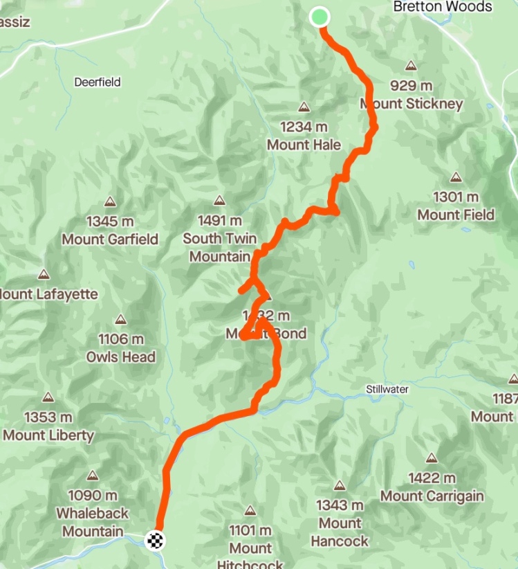
Strava GPS of our route
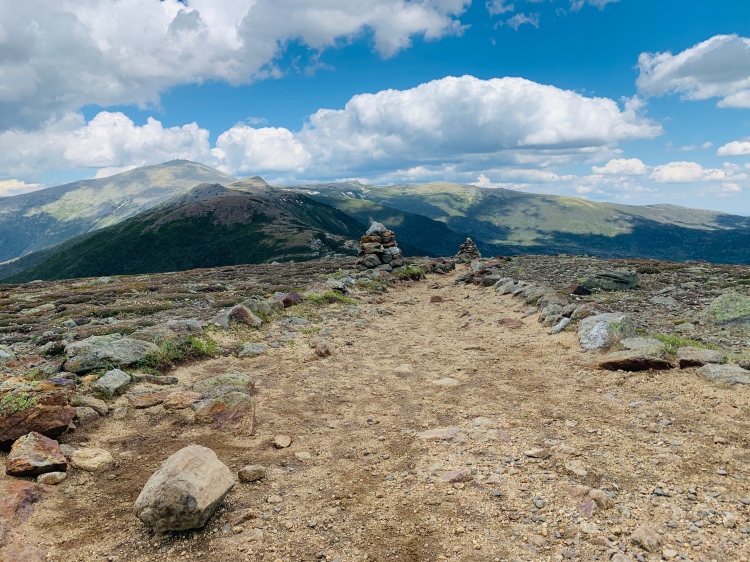
Hike info: Starting at Zealand Road, covering Mt. Zealand, Mt. Guyot, West Bond, Mt. Bond, and Bondliff. According to my Garmin watch: 21.64 miles and 4,636ft. elevation gain (4,301ft according to Jess’s watch… they rarely agreed).
Trails taken: Zealand Road, Zealand Trail, Twinway, West Bond Spur, Bondcliff Trail, Wilderness Trail, Lincoln Woods Trail.
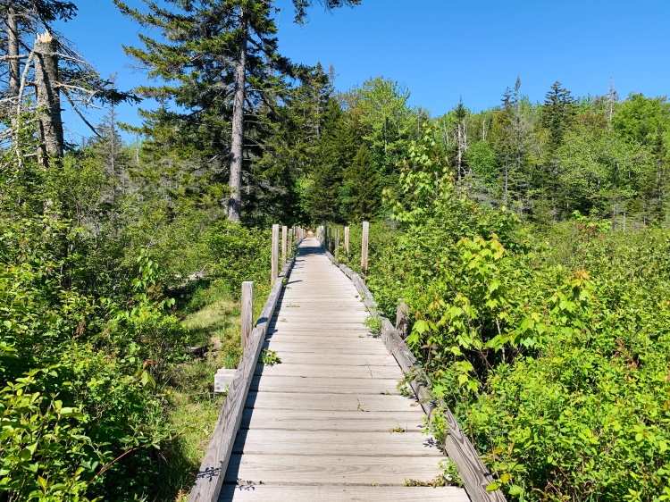
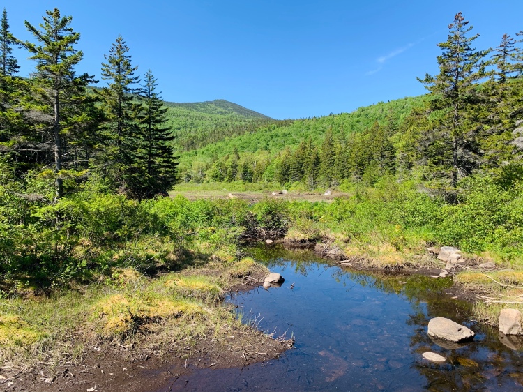
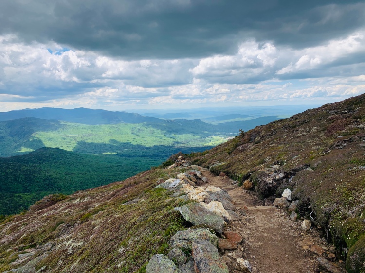
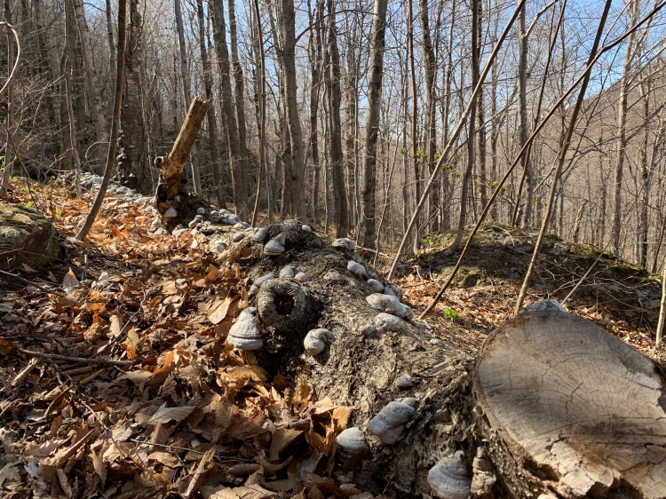
Bridge along Zealand Trail
We began our hike at the Sugarloaf Trailhead, as Zealand Road was still closed mid June. This added a lovely 2.6 mile warm up to our day. Why not, right? Honestly the road walk wasn’t awful and went by real quick. The road and the first part of Zealand trail, up until just before you reach Zealand hut are relatively flat and make for quick morning miles.
My favorite part of Zealand Trail is the bridge in the above picture. Hands down my favorite bridge, that I know of, in the White Mountains. I remember my first time hiking Zealand in 2017, it was one of my first 4000 footers (before I know what the heck I was getting myself into). This bridge, and Zeacliff are some of my best memories from my “early hiking days”, and will forever remain some of my favorite places on trail.
The day before this Zealand and Bonds, we hiked Franconia Ridge from Skookumchuck to Osseo (another traverse, another car spot). Mondays in June tended to be our “tired” day – getting back into the swing of things for another week of hiking after the resting weekend. The weather this third week was PRIME for Pemi hiking, and Pemi hiking we did (all of it actually, minus Owls Head!).
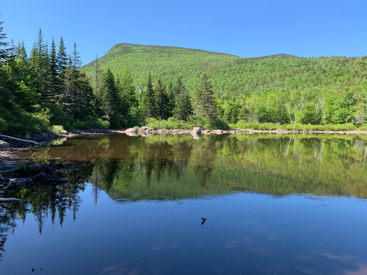
Magical places in the woods along Twinway by Zeacliff
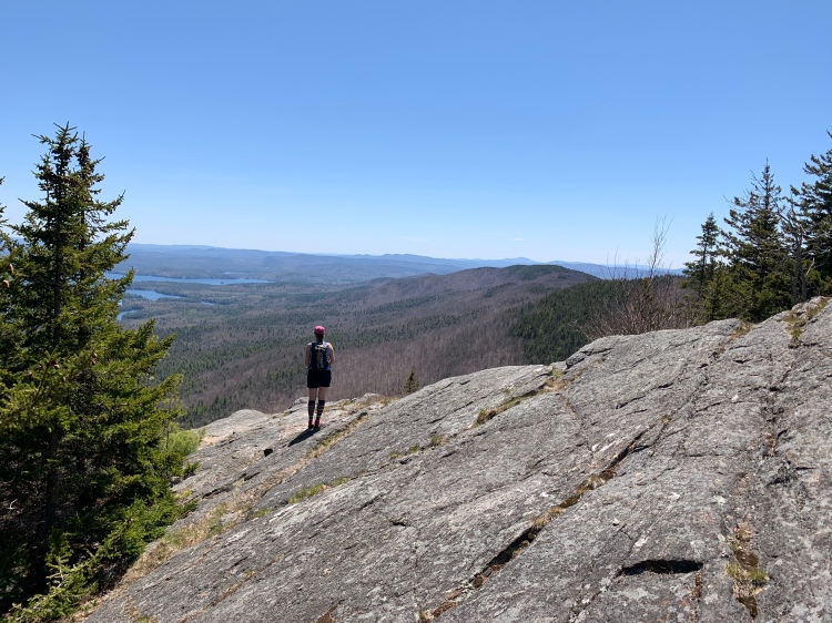
Zeacliff
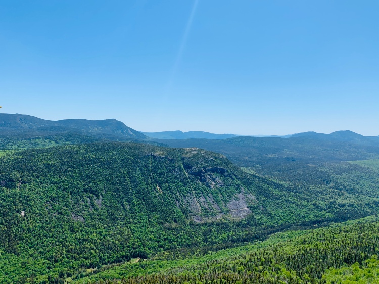
At Zealand Hut/Zealand Falls (the hut was also closed at this point), we topped off our water from the falls and had a quick snack break before beginning the first “real climb” of the day. The section of trail between Zealand Hut and Zeacliff lookout is a climb, for sure. But it’s worth it, it’s always worth it.
Zeacliff and the section of trail shortly before and after it (pictures above) are stunning. Zeacliff was actually the first hike I did back in the Whites and then Pierce first mountain following my last stress fracture a few years ago. Apparently a good tester hike when getting back from injury? Don’t take my word for this, obliviously… please and thank you.
At Zeacliff we took another break, because, it was a gorgeous day and June wasn’t about kicking our butts to be fast.. rather actually being able to hike all 48 in a month, and to actually enjoy it.
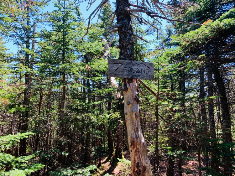
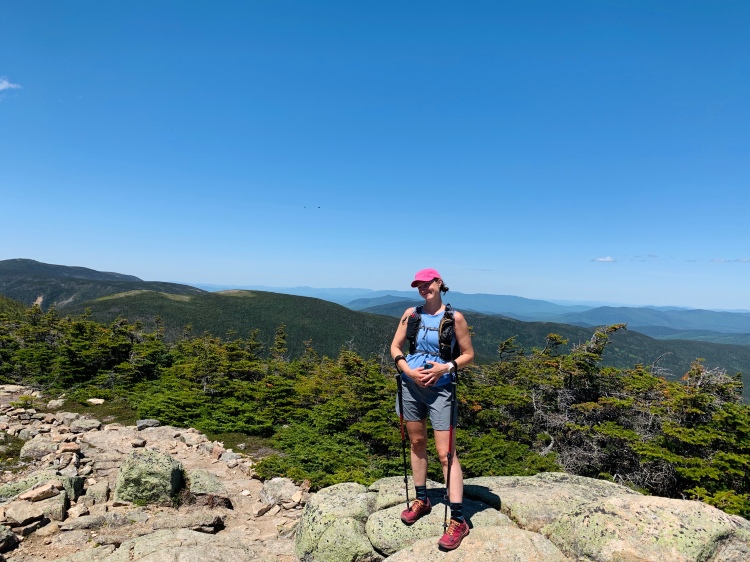
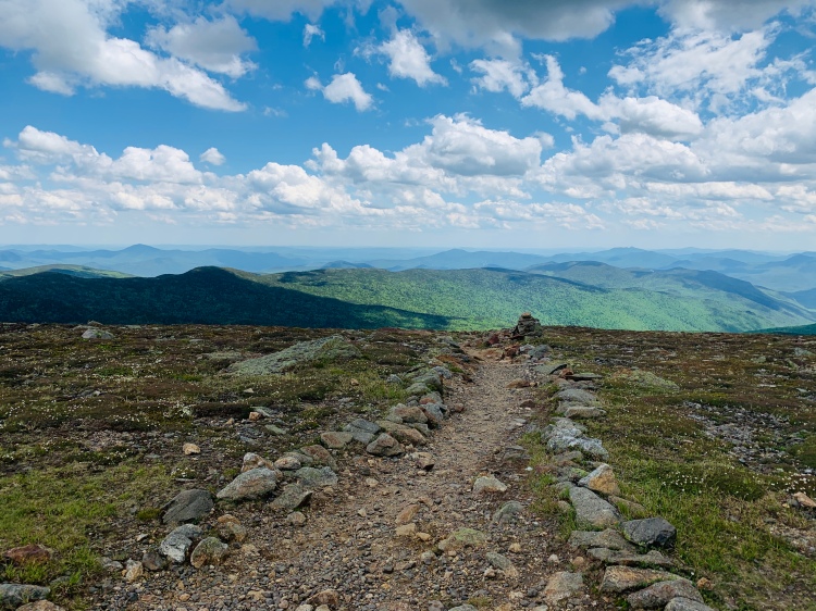
The best summit sign
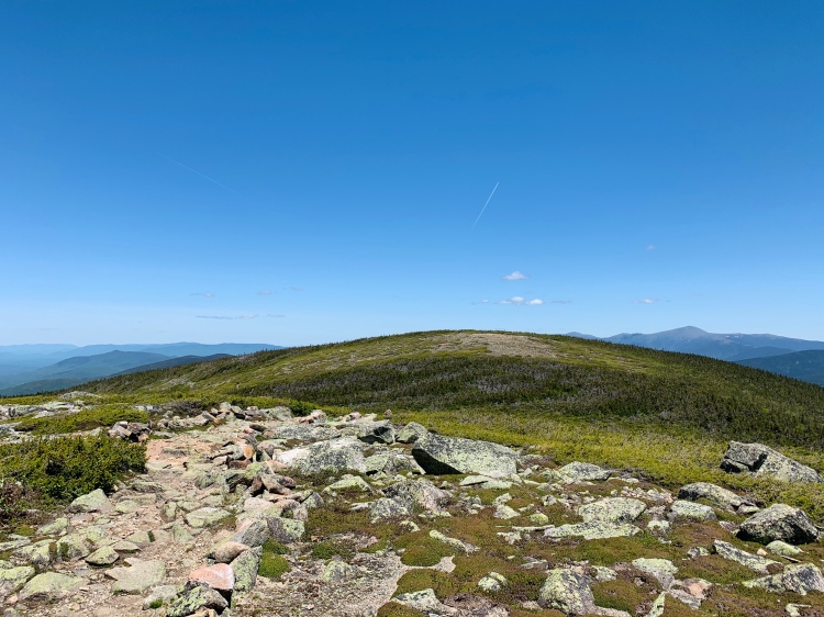
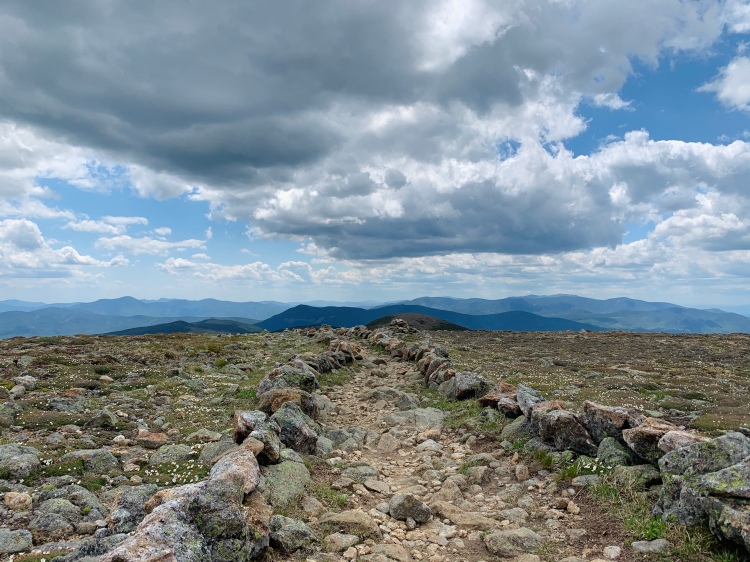
From Zeacliff to Zealand was a rather quick jaunt. The terrain isn’t tough here, and it’s a little bit of ups and downs before Zealand spur to the summit which always makes me question “did we pass it?!”. We didn’t. At the summit it was “backpack yardsale” (take everything out of your pack for wide display) time as yours truly left the zipbloc holding my water filter/dirty water bladder unzipped and thought something was leaking in my pack… it was… thankfully the filter and not my actual water. Good job Sarah. A+.
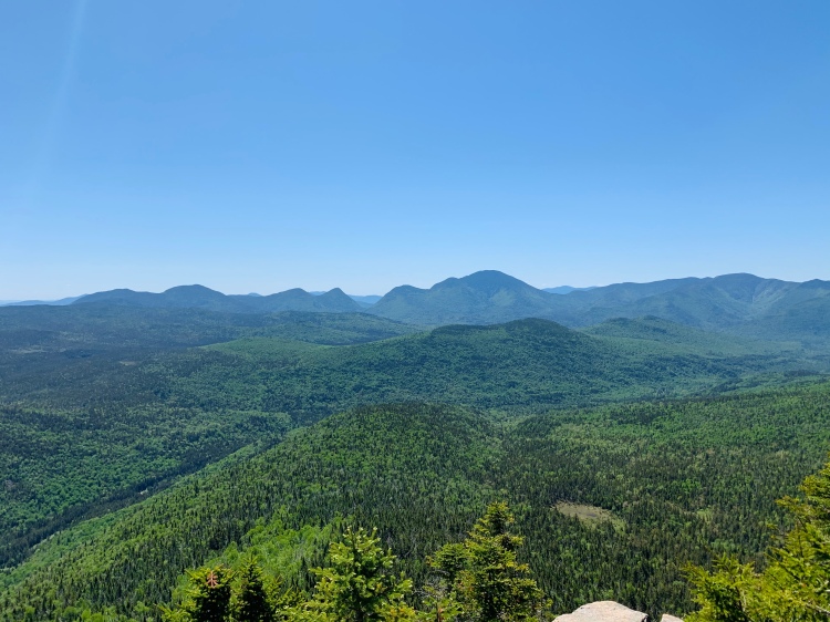
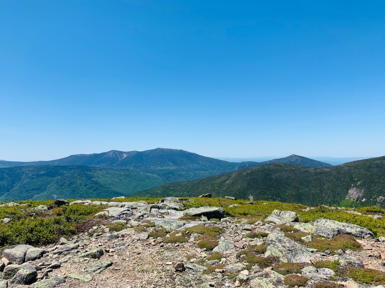
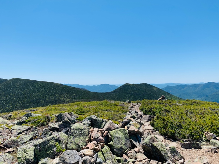
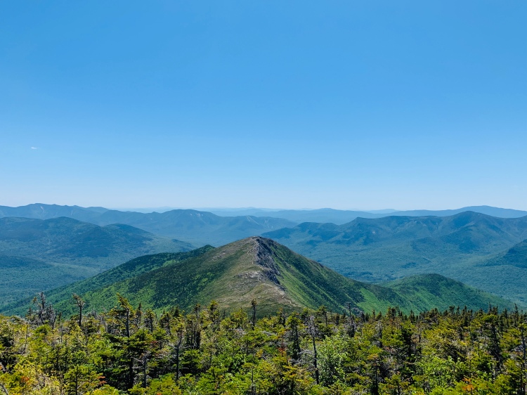
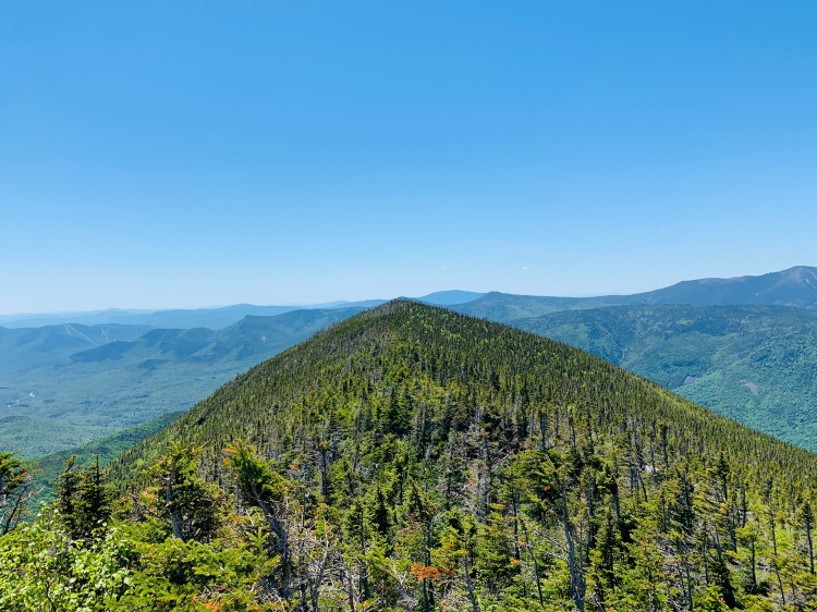
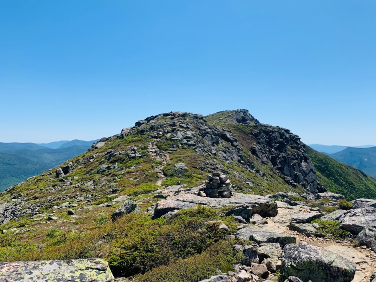
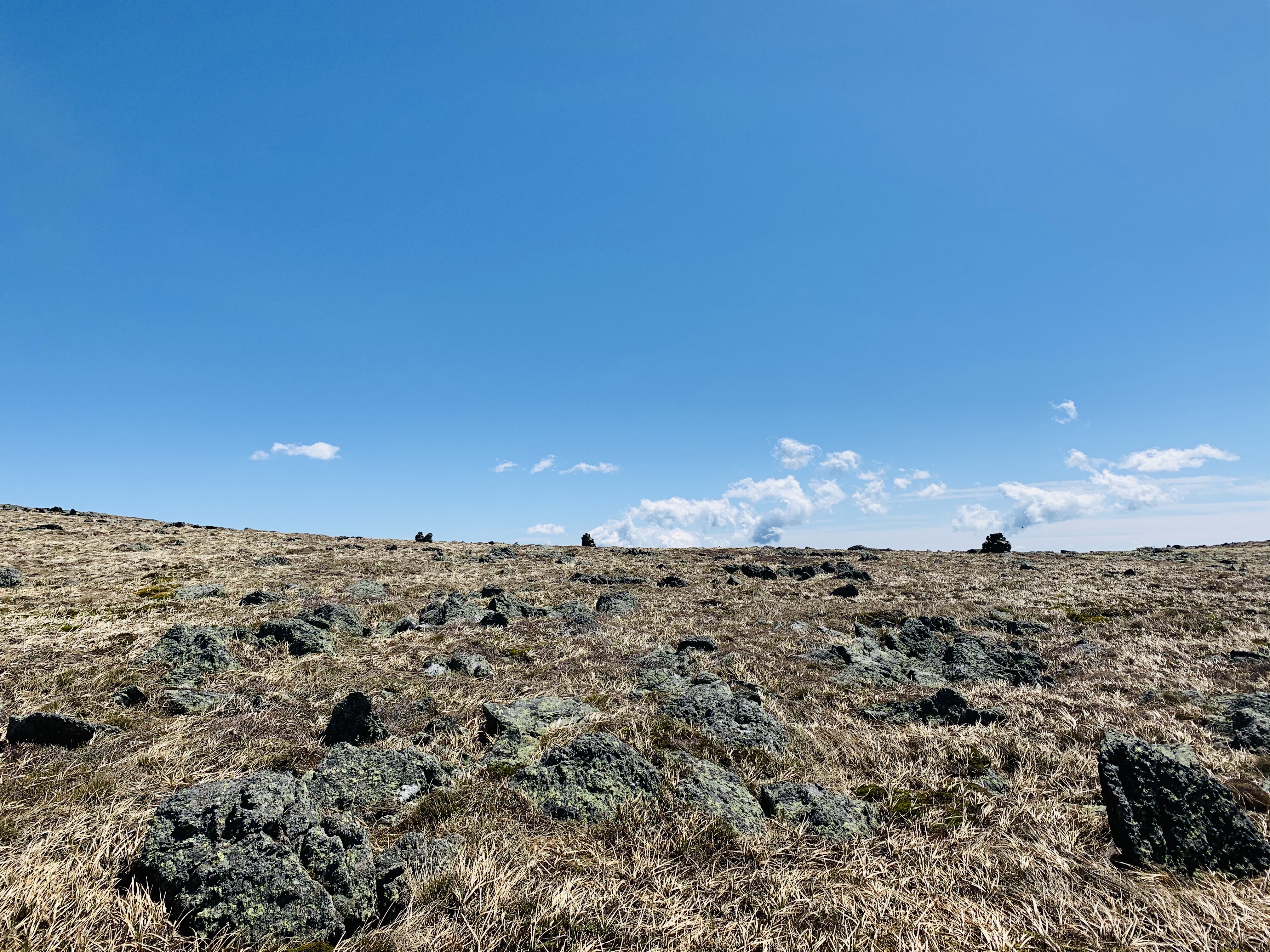
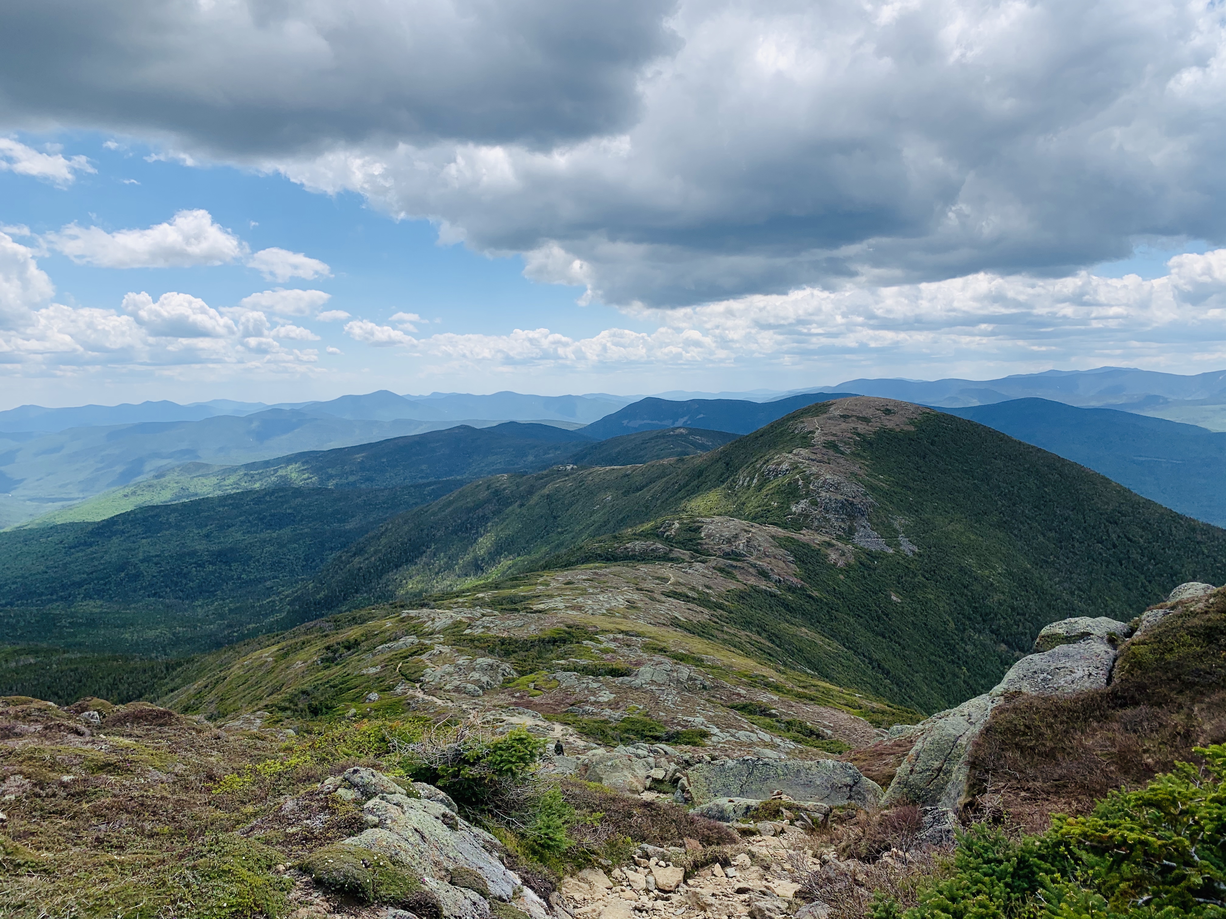
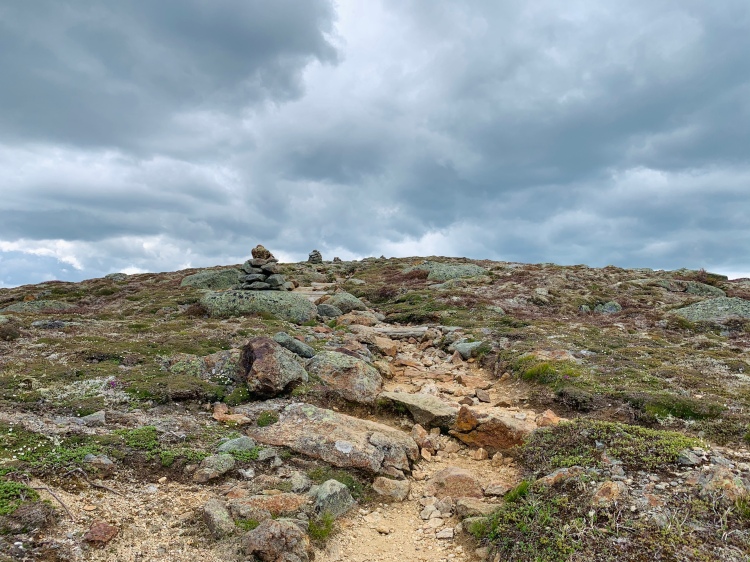
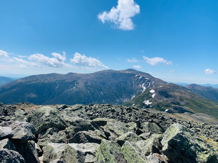
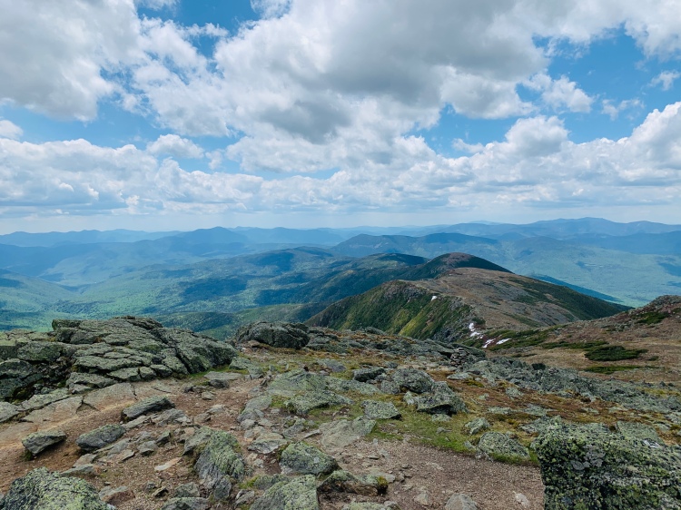
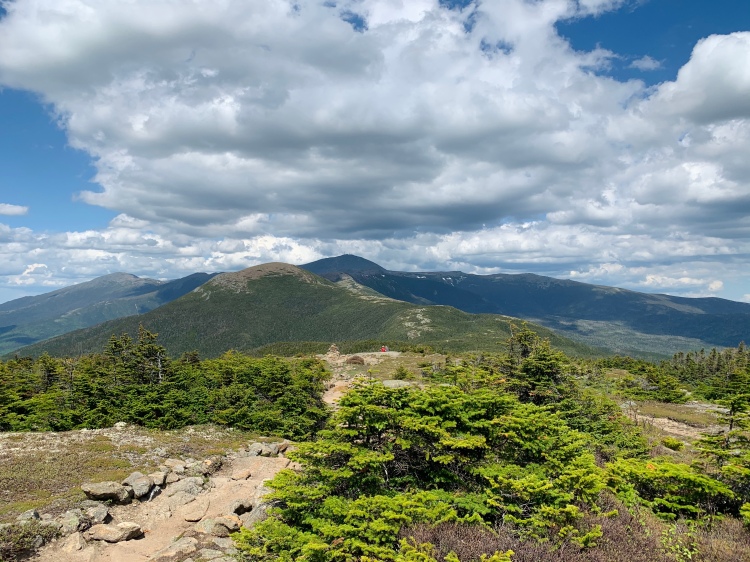
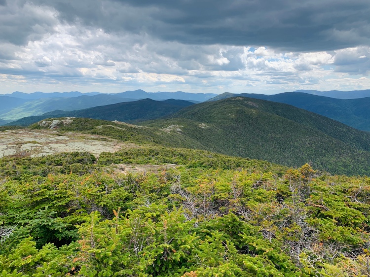
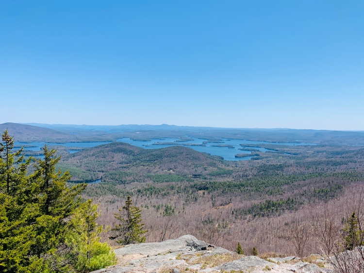
After Zealand, you’re in the woods for another mile or so before popping out above treeline close to Mt. Guyot. From this point it’s fairly exposed until right after Bondcliff, with the exception of West Bond Spur and the section just before and after this.
Guyot!
There is something magical about the Bonds (and Guyot). The last time I was on the Bonds was September 2018, and Bondcliff finished my first round of the NH48. On this day, I was giddy to hit the Bonds for round two and near the finish of round two (at this point, only Owls and Moose were still needed)! I guess that’s a perk of hiking all of these in a month, you finish whatever round you’re working on and get a good start on the next one 😉
One of my “goals” for this current summer is a Pemi loop, so between this Zealand and Bonds traverse plus the two other Pemi hikes that week I was really getting excited about the Pemi loop! I think it’s good for me to have hiked all of this so recently as I move forward now in July and into the fall with other goals in these mountains. I never would have expected being able to do these hikes, this close together, years ago. The Bonds and Owl’s Head were my only big hikes summer 2018, my body handled them fine then but this would have been too much at this point from a bone density/injury risk perspective. It’s really cool to see how far I’ve come in two years with gaining my endurance/strength tank, but most importantly with allowing my body to trust me again. Thanks, body. Thanks.
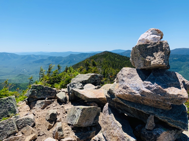
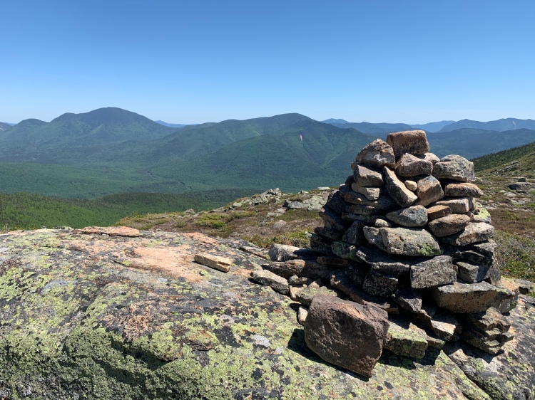
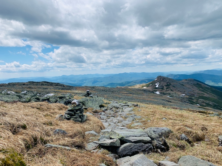
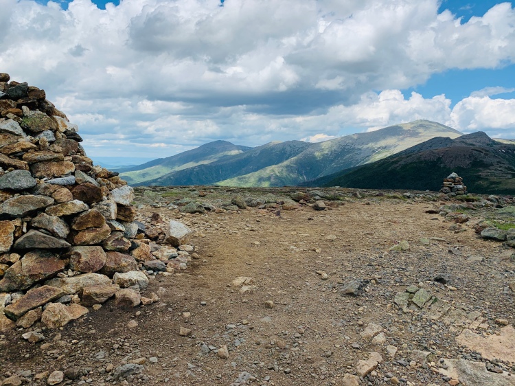
West Bond summit cairn
West Bond is the first of the Bonds coming from Zealand direction and is my favorite of the Bonds. Yep, even over Bondcliff. There is something about the little spur path that brings you to the summit. And there is something about the remoteness of the summit. I dig both, and West Bond still remains one of my favorite peaks. Looking forward to being back there soon!
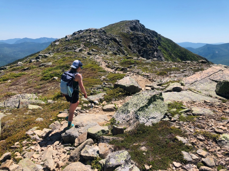
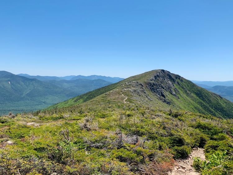
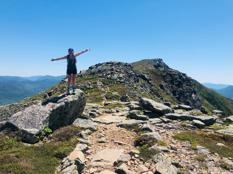
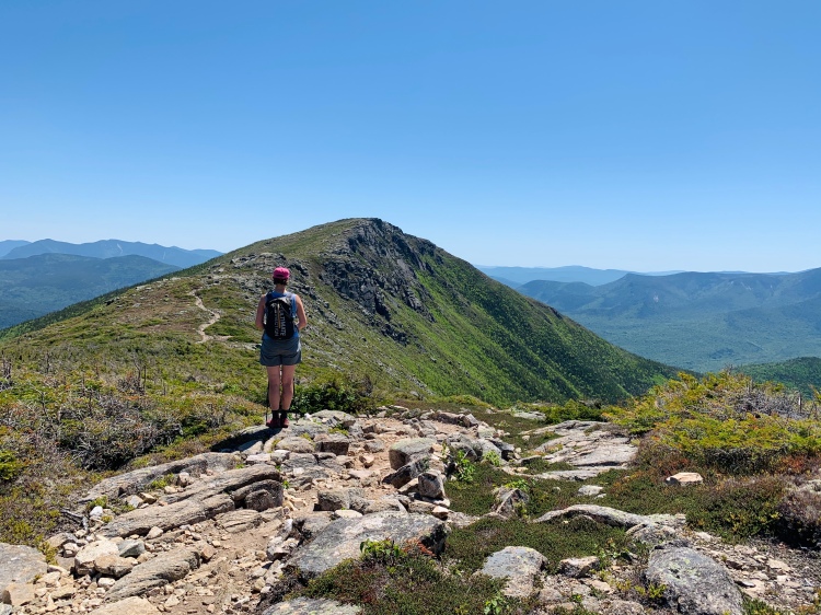
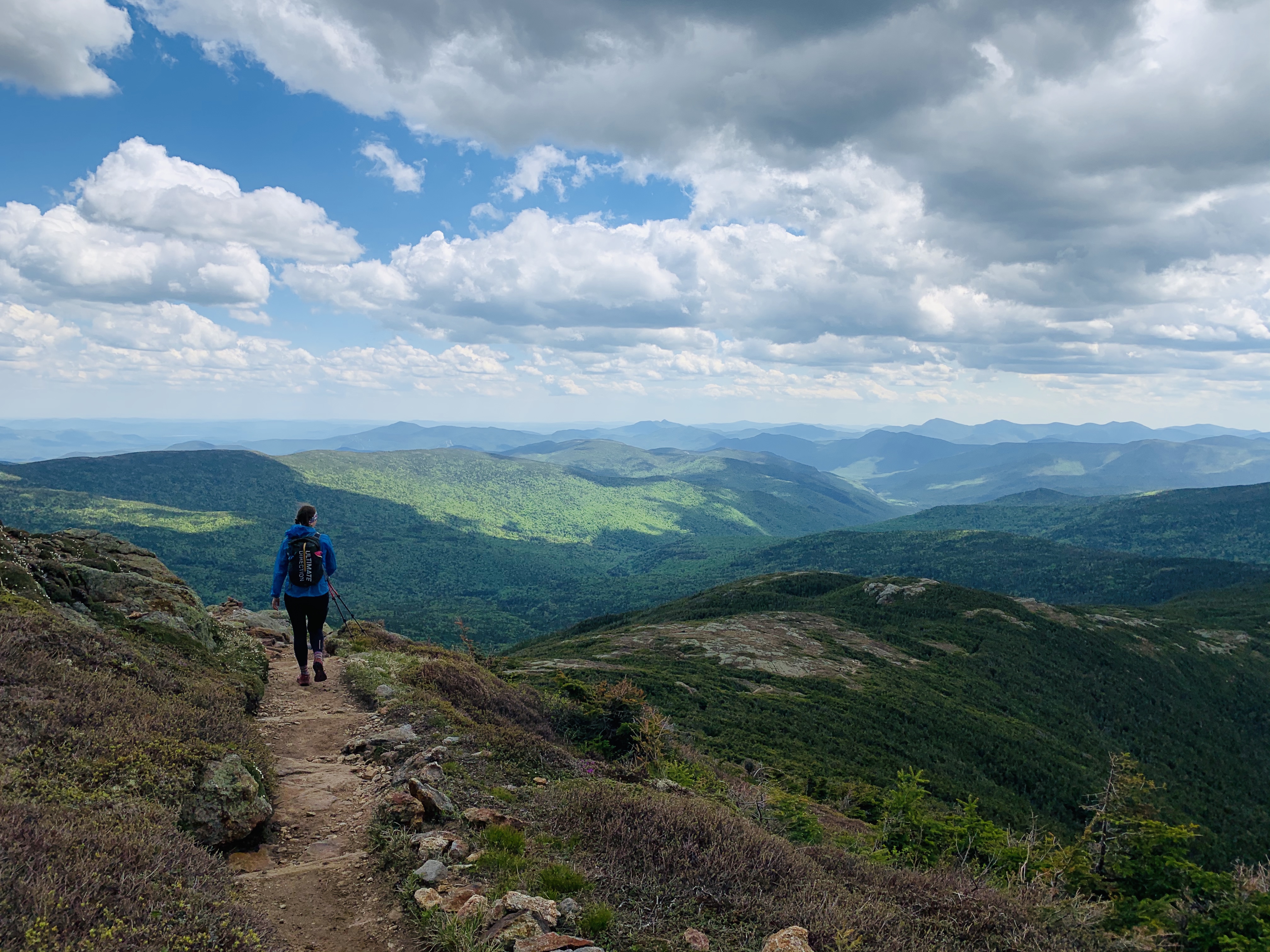
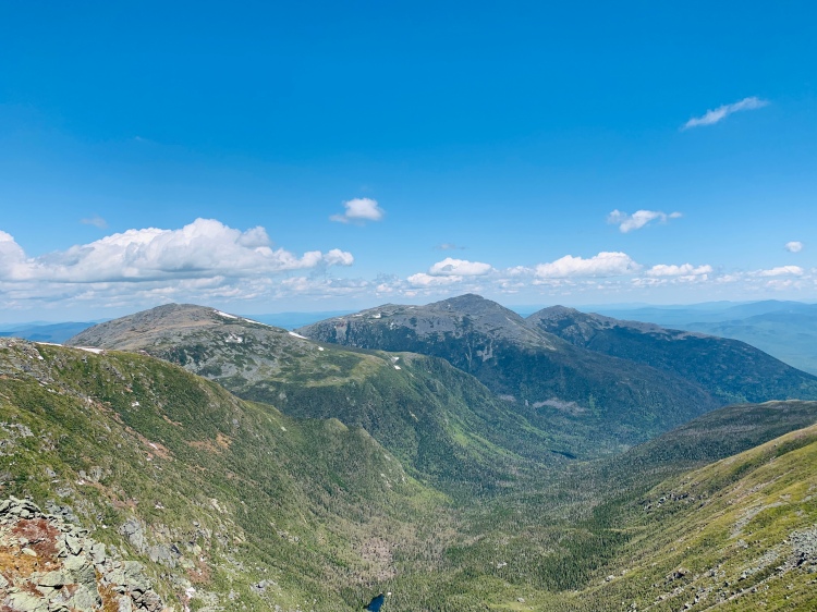
From West Bond, we headed to Mt. Bond and quickly kept going towards Bondcliff, the final peak for the day! It was amazing how few people we saw on this day. And it felt a little strange having seen so many the day before on Franconia Ridge – but that was very much to be expected. Still, the Bonds are popular so we enjoyed the lack of humans on this day.
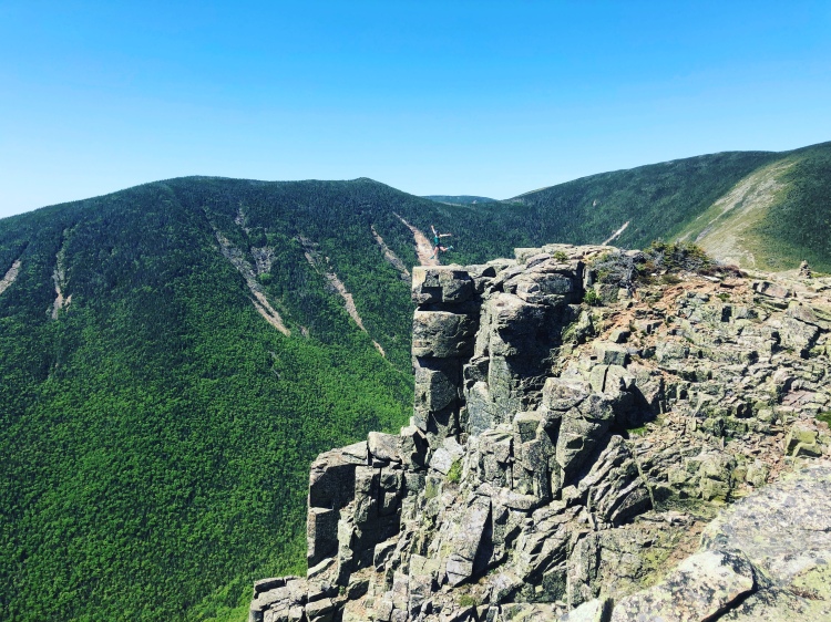
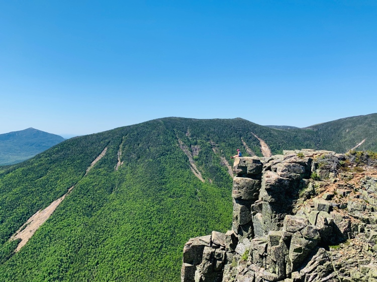
To Bondcliff (Narnia) we go!
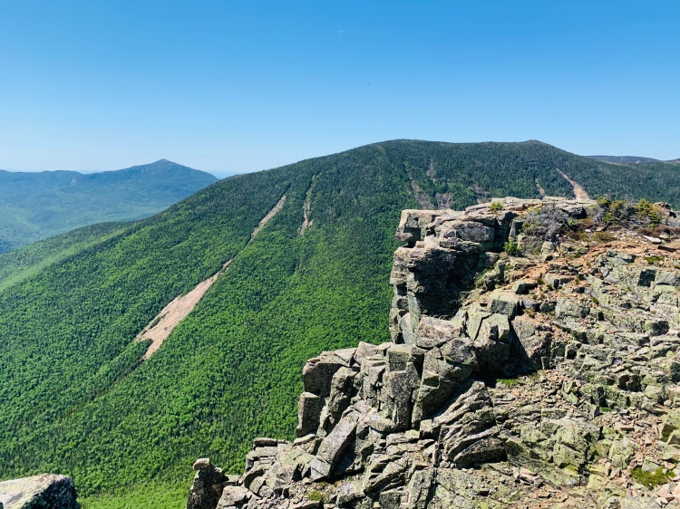
How Jess felt about getting to Bondcliff? Anti-climactic?
At the summit we first did a sandwich and stretch break – both essential. I’m still deciding if I want to do a “stats” post for June – miles hiked, miles drove, elevation, sandwiches consumed… would be fun… right? right. Next up was picture time – Bondcliff is so iconic for photos in the Whites, so we had to take our share of summit pictures! One of my favorite summit photos is from the first time I was on Bondcliff and is the header image on my other website! While
Me! Jump jump.
Jess
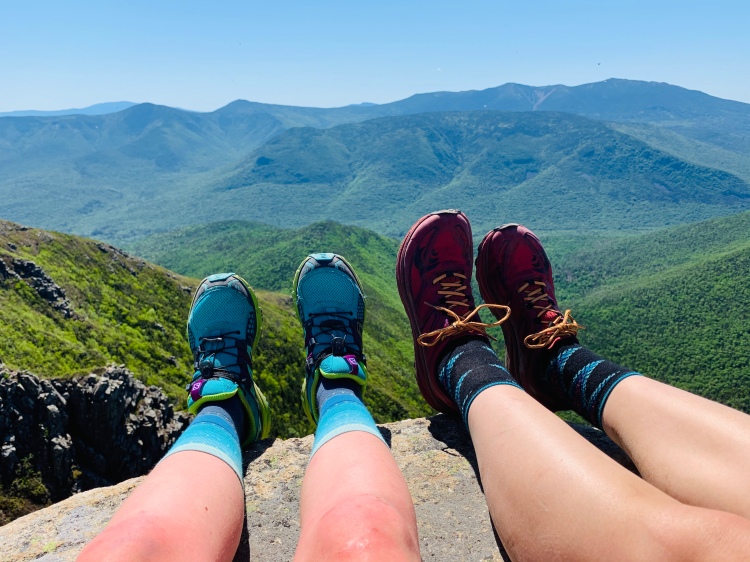
“hiking mates”… well our feets.
This was my first time hiking from Bondcliff to Lincoln Woods, as my first round of the Bonds was hiked as an out and back from Zealand. Let me tell you, for those of you who haven’t hiked this… lots of flat. Pancake flat. Which honestly was well welcomed at the end of this hike with all the other hiking we were doing. Bondcliff Trail off of the Bonds, the Wilderness Trail, and Lincoln Woods Trail all follow along the Pemi so the hike out is accompanied by a river and the very serene sound of flowing water that comes with that. This is an example of one the things I “took for granted” in my first years of hiking – the little things. The sound of flowing water, birds chirping, flowers alongside the trail, the history of these trails (which thanks, Jess for teaching me more about this), gentle trails (while I do love my boulder scrambling). These things matter, and they are beginning more and more to matter to me. It’s so much more than the hiking, the summits. It’s also so much more than the little things, for me. But, that’s a story I’ve told before and will continue to tell over the years.
Upcoming are more recaps from this month, recaps from my current hiking escapades, and a post to recap this “June project” (which I think I need Jess’ help on for her perspective).
“I see myself forever and ever as the ridiculous [person], the lonely soul, the wanderer, the restless frustrated artist, the [person] in love with love, always in search of the absolute, always seeking the unattainable.” Henry Miller
I’m apparently on a roll of posting a monthly blog post, as the last post I wrote was May 14th recapping the Squam Range Traverse. Today I’m back with another hike recap, shocker, I know.
Before getting into the Mt. Jefferson to Mt. Jackson traverse, let’s chat about life lately real quick. I’ve been hiking A LOT. Like, A LOT A LOT. And, completely digging it. Hands down the highest volume of hiking I’ve ever done/sustained and knock on all the possible wood but my body feels good and rest days are magical as well. The month of June has been an interesting and humbling month as all the hiking is related to a “June hiking project”.
Being someone that normally doesn’t set goals directly but who also competed nationally in sport as a child, this experience been out of my recent element but also a total blast. At the end of the day, and even the end of each week, I’m finding myself just proud of myself and the human I’ve been hiking with for most of the hikes, and just genuinely fulfilled. Hiking, nature, the woods – they feel like home. Everything flows. Everything makes sense.
Outside of the hiking project — I’m nearing the end of my Sports Nutrition course and will start the final exam/certification process soon, I have a job interview next week for a position at a addiction treatment center, have been low-key looking at graduate programs, made some mega changes to my business website, and have been doing loads of internal reflection on what I want to continue/start/stop “pursuing”/including in my life.
Now, onto the hike recap:
GPS from Strava
Hike info: Covering from Mt. Jefferson to Mt. Jackson (6 peaks) in the Presidential Range in New Hampshire, 18.2 miles and 6,680 ft. elevation gain.
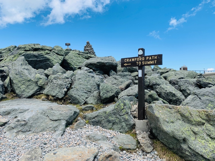
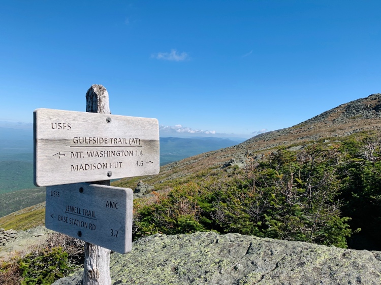
Trails taken: Jewell Trail, Gulfside, Jefferson Loop, Monroe Loop, Eisenhower Loop, Crawford Path, Webster Cliff Trail, Webster-Jackson Trail.
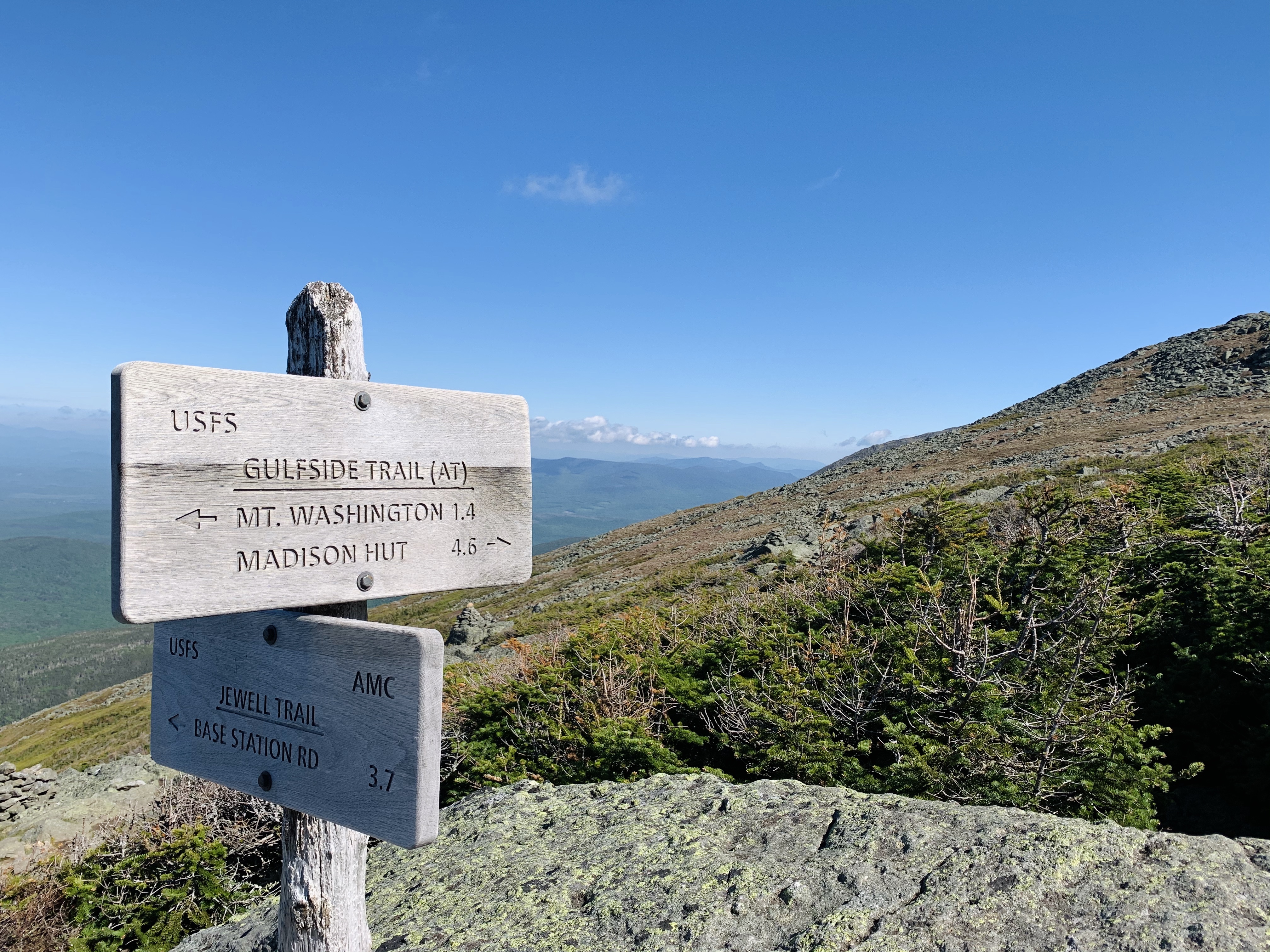
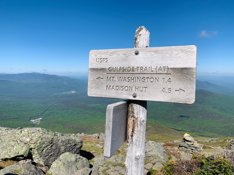
First trail junction of the day
Jess and I met at the Depot Lot in Crawford Notch in the morning to leave a car for the end of the hike. From there, we carpooled (in masks… something we’ve been doing all along) to the Cog parking lot where we started up the Jewell Trail from. You can pick up Jewell Trail from its trailhead across the street from the Ammonusuc Ravine parking lot, or at the Cog Railroad lot. We opted for the ladder to cut off a little mileage as we had “enough” miles planned that day/that week/this month. Why add more.
Had Jefferson Notch Road been open, we likely would’ve taken Caps Ridge Trail up Jefferson to start versus taking Jewell Trail up to Gulfside, over to Jefferson and back (as you can see on the above GPS, we retraced a little over a mile and a half. Caps is also a lovely (and fun) approach.
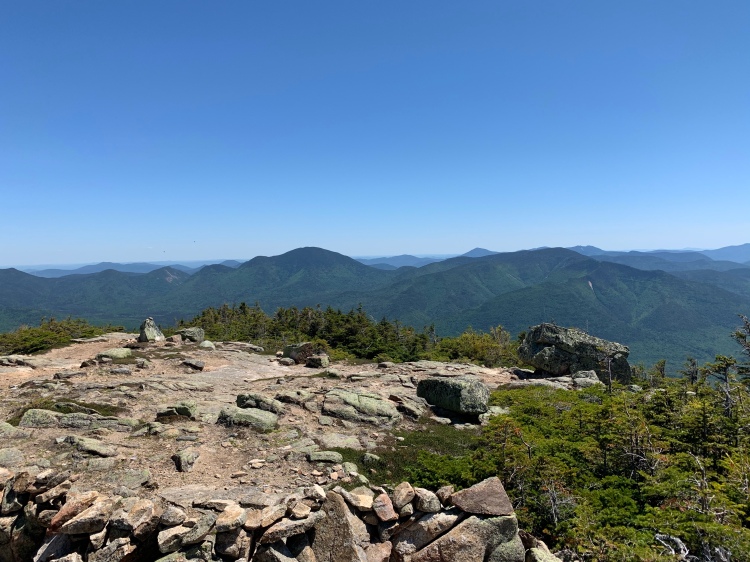
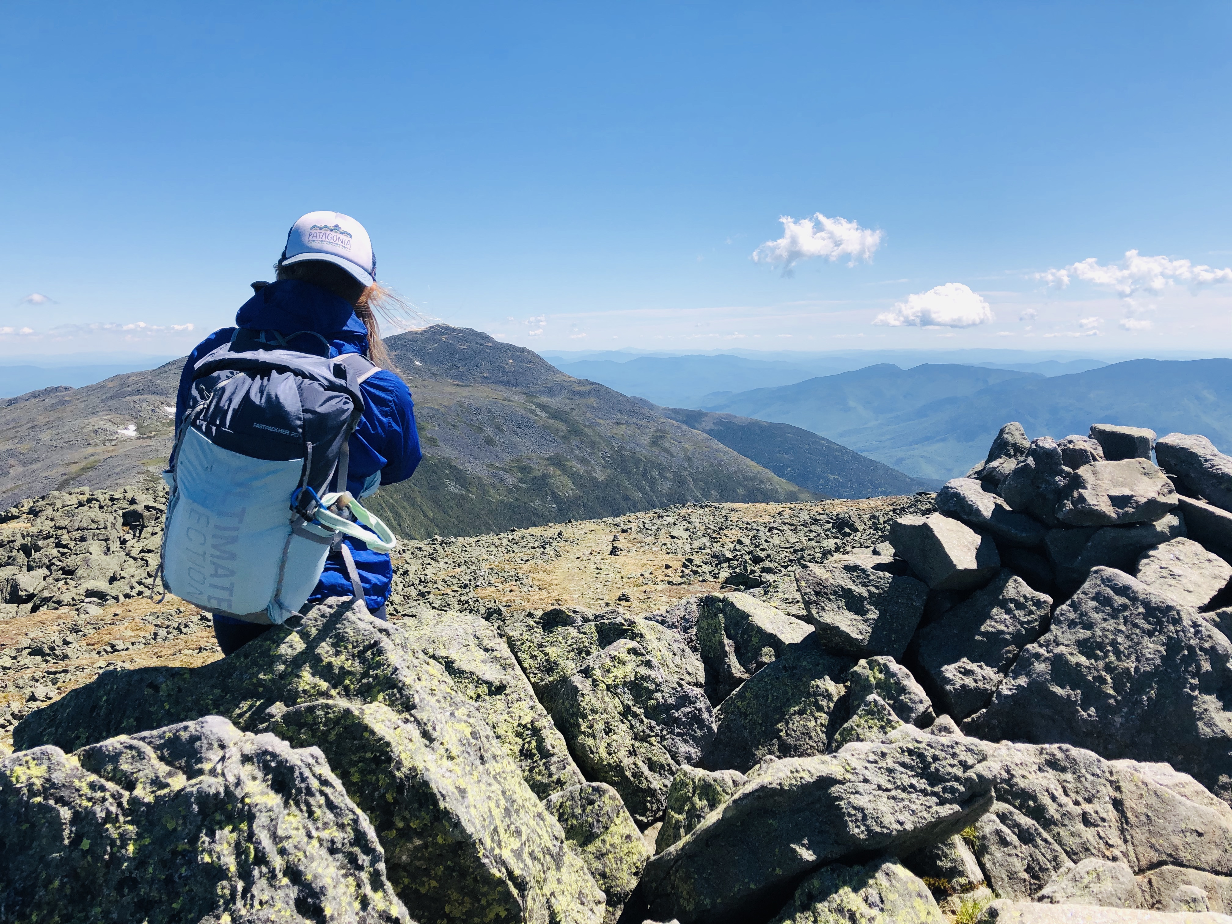
Sitting on Jefferson summit, looking at Adams
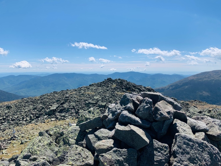
Jefferson summit rock pile
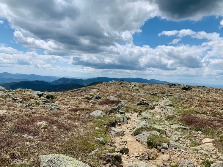
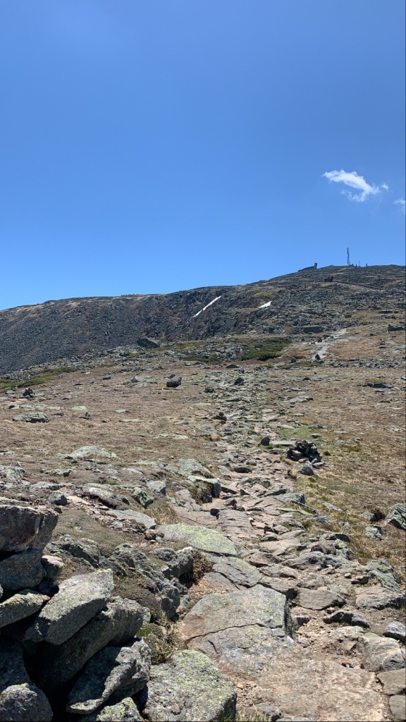
A little before the intersection of Jewell and Gulfside trails, you leave treeline and remain above treeline. For this hike, we were above treeline until the section between Mt. Eisenhower and Mt. Pierce. The day of this hike was a WINDY one. Higher summits forecast called for 30-40mph sustained wind with guts up to 50mph. Let me tell you, this was the windiest hike I’ve ever done. While I’ve been in wind this strong, it’s never been for this duration of time, or sustained winds. Definitely an experience. I was certainly glad the temperature was fairly warm and the skies were sunny.
Earlier in the week, we had intentions of a full Presidential Traverse (two days before this hike). When getting up to the Madison Spring Hut we knew this wasn’t happening as the forecast was not in our favor that day. We submitted Madison and then called it, deciding we would hike Adams solo another day and then Jefferson to Jackson later in the week. While I’m cool with wind in warmer temps and sun, the day of Madison was socked in, cooler, and drizzling. #notafan. Working on my comfort zone I suppose? Yes, yes, this is good for me.
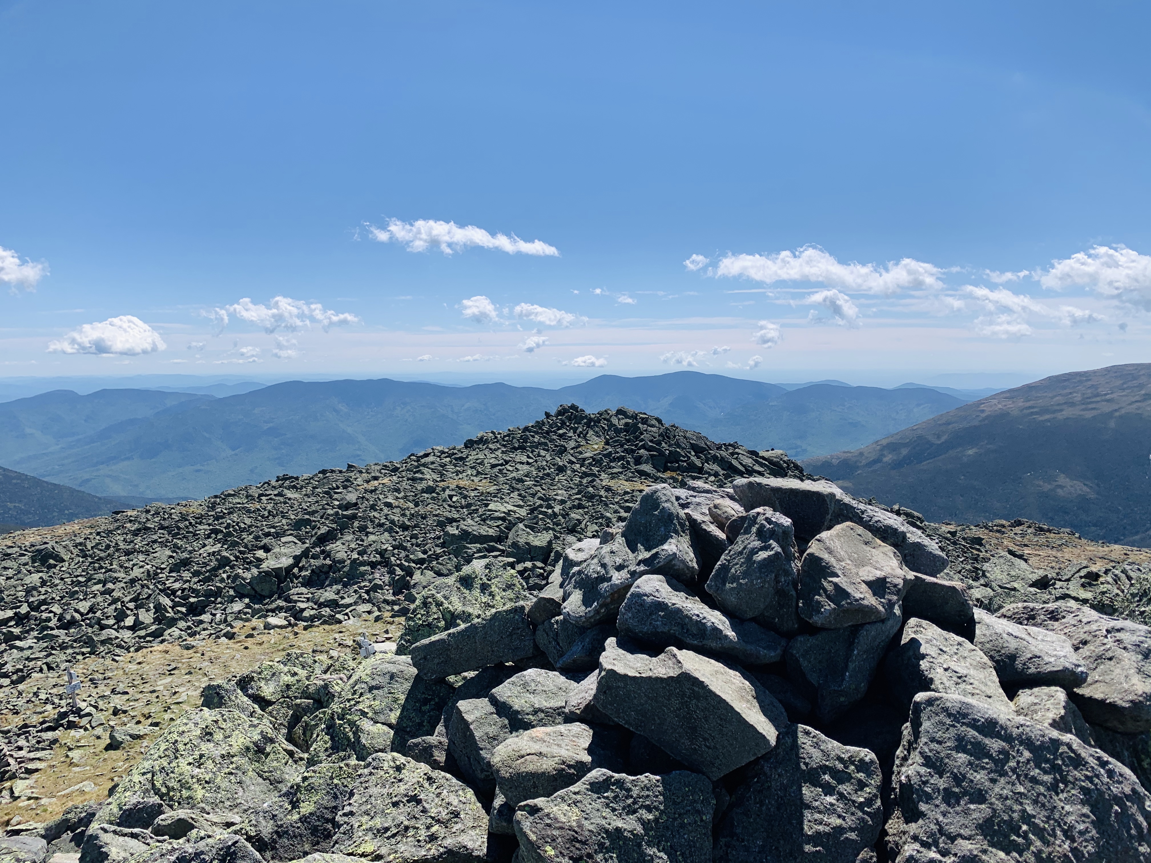
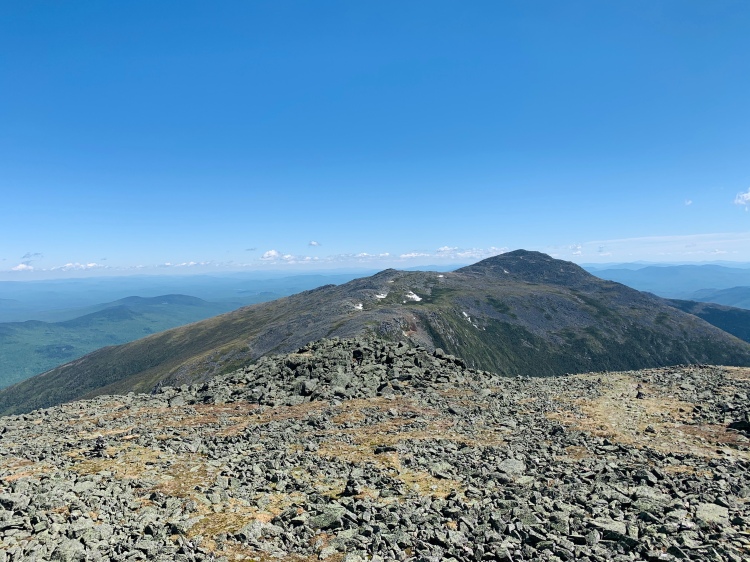
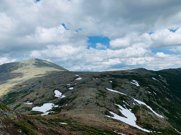
Walking on Gulfside headed back towards Washington
Alongside Gulfside Trail
Mt. Jefferson is one of my favorite peaks of the NH 48. Monroe too. So, this hike day was surely a favorite. This was my first hike linking multiple presidential peaks since mid-Winter and it was a treat to be up on those higher exposed summits again for a full hiking day.
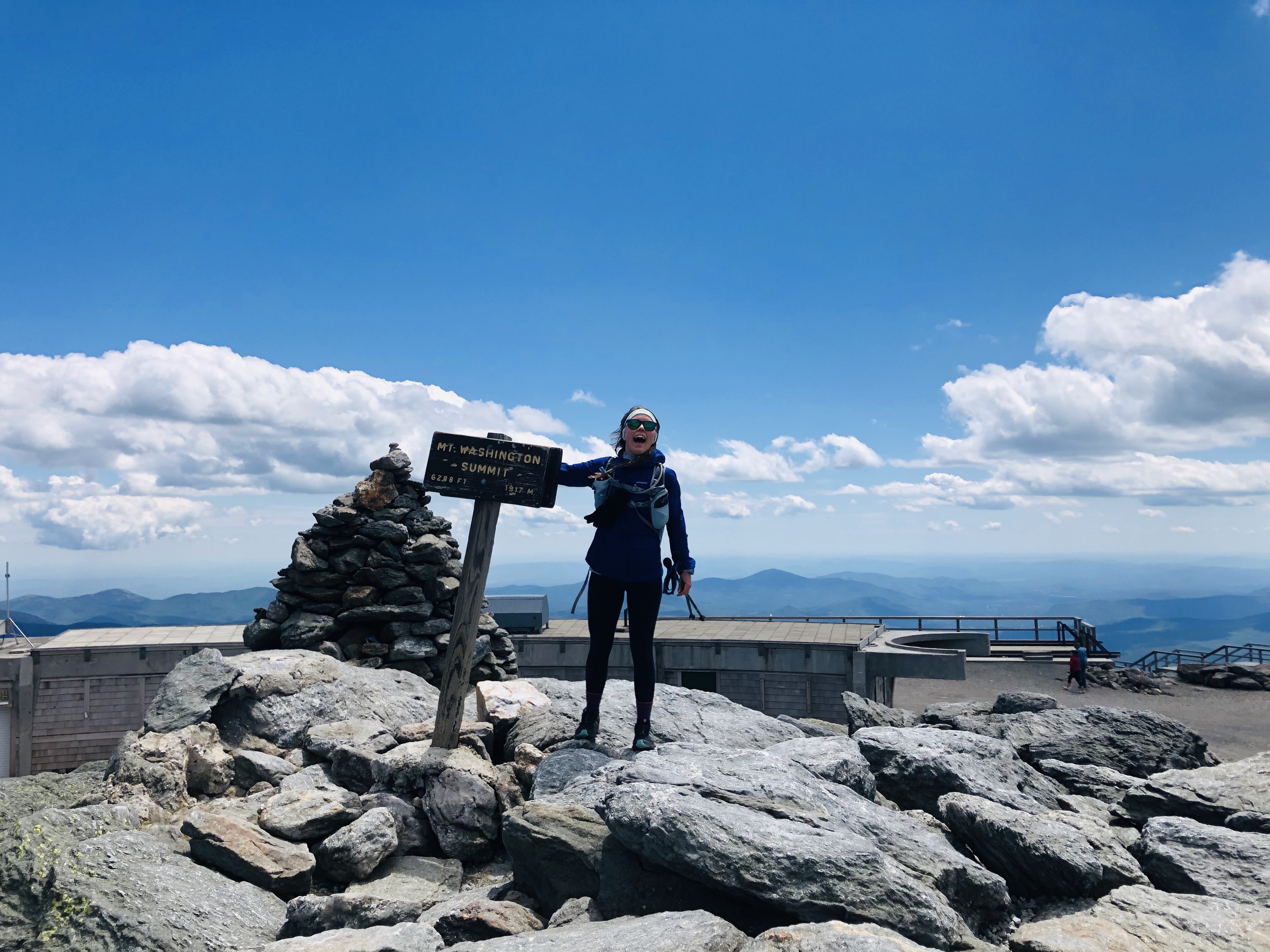
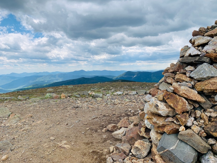
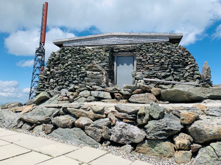
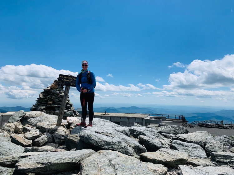
After summitting Jefferson, we headed back towards Washington. Unlike Jefferson and Monroe, Washington is one of my least favorite peaks, mainly because it’s not exactly an empty summit per se. With everything going on around COVID right now, Washington wasn’t busy this day outside of the mass of skiers and snowboarders we saw on Gulfside Trail as we approached the summit. This was the first hike of Washington I’ve done where there wasn’t a line to take a photo with the summit sign – a slightly off-putting feeling.
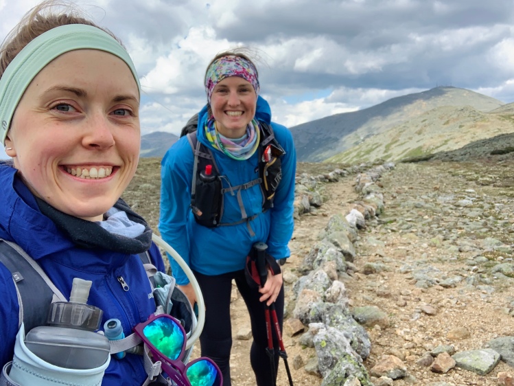
Yay hiking!
After reaching Washington we quickly left and continued onwards toward Monroe. With higher winds on the summit and not wanting to need to add any layers, plus a chance of afternoon T-storms, it was best to at least get ourselves off the highest summit of the day.
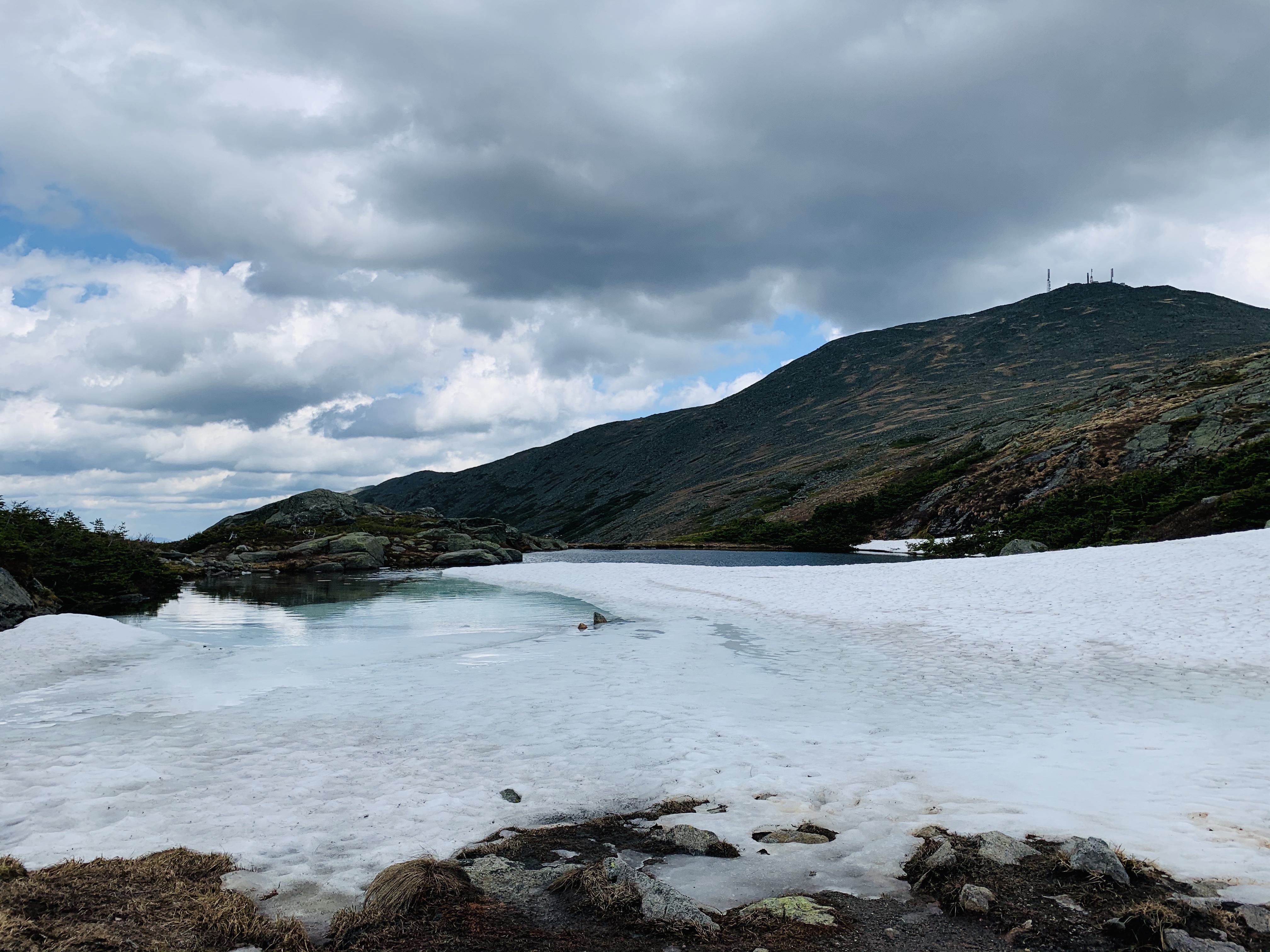
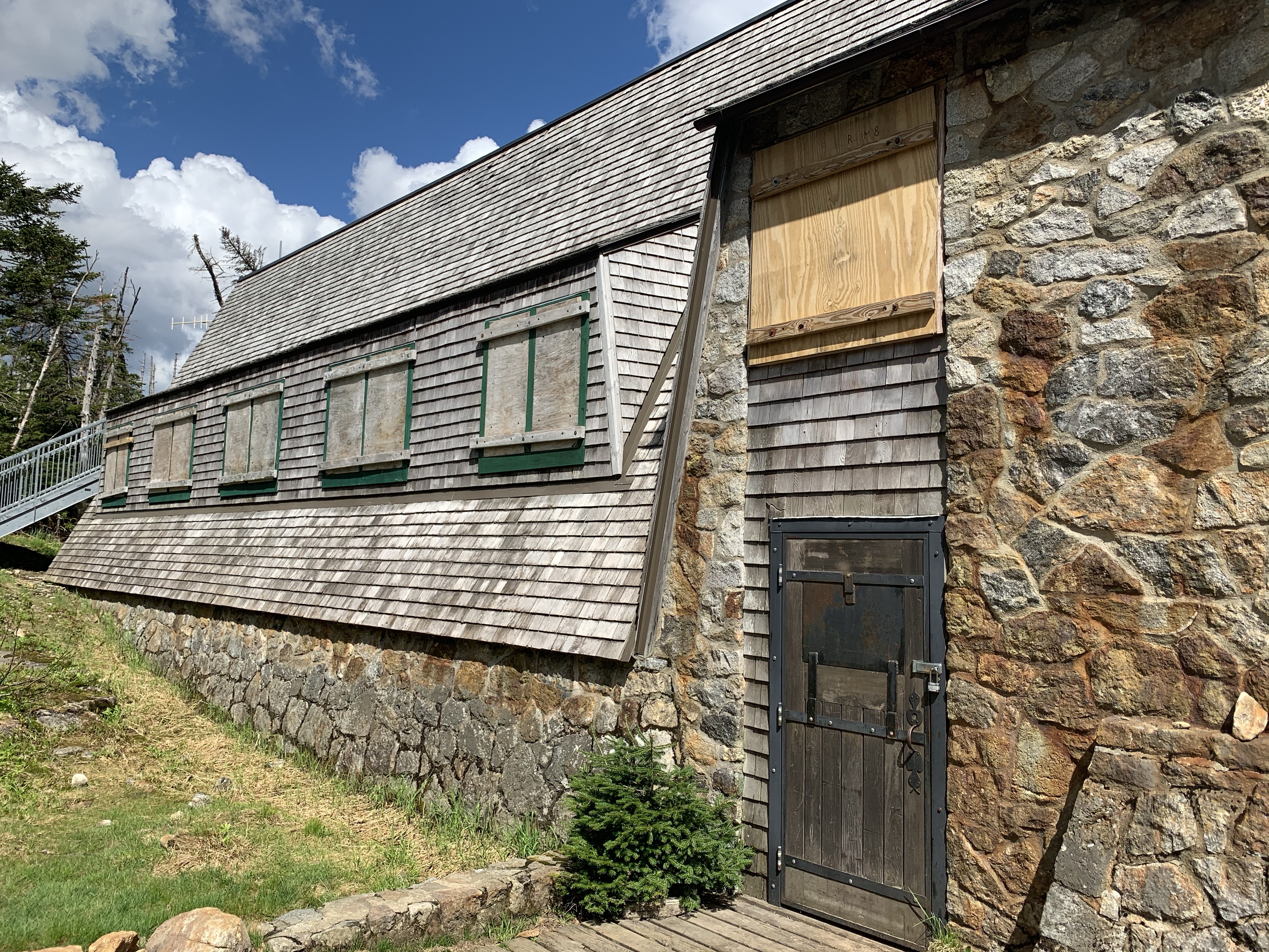
The hike from Washington to the Lake of the Clouds went by quick and we were surprised to see a fair amount of ice and snow remaining on the Lake. Not surprising was a closed Lake of the Clouds hut. Alike Washington summit, with COVID, the AMC huts have been closed (although some are now opening for certain uses as far as I know). It’s been a little strange hiking during this time, with trying to distance, cover our faces, and yet still wanting to be friendly. The vibe has felt a little off in general although we have had some hikes were it felt more “normal”.
Semi-frozen Lake of the Clouds
After passing by the hut we took a quick snack pit stop at the trail junction where you can either take Crawford Path and bypass Monroe or the Monroe Loop Trail. The last time I was on Monroe was during a hike of Monroe and Washington last summer with my friend Dawna. A surprise surprise (sarcasm) is that day also had a chance of T-storms. Welcome to summer in the White Mountains.
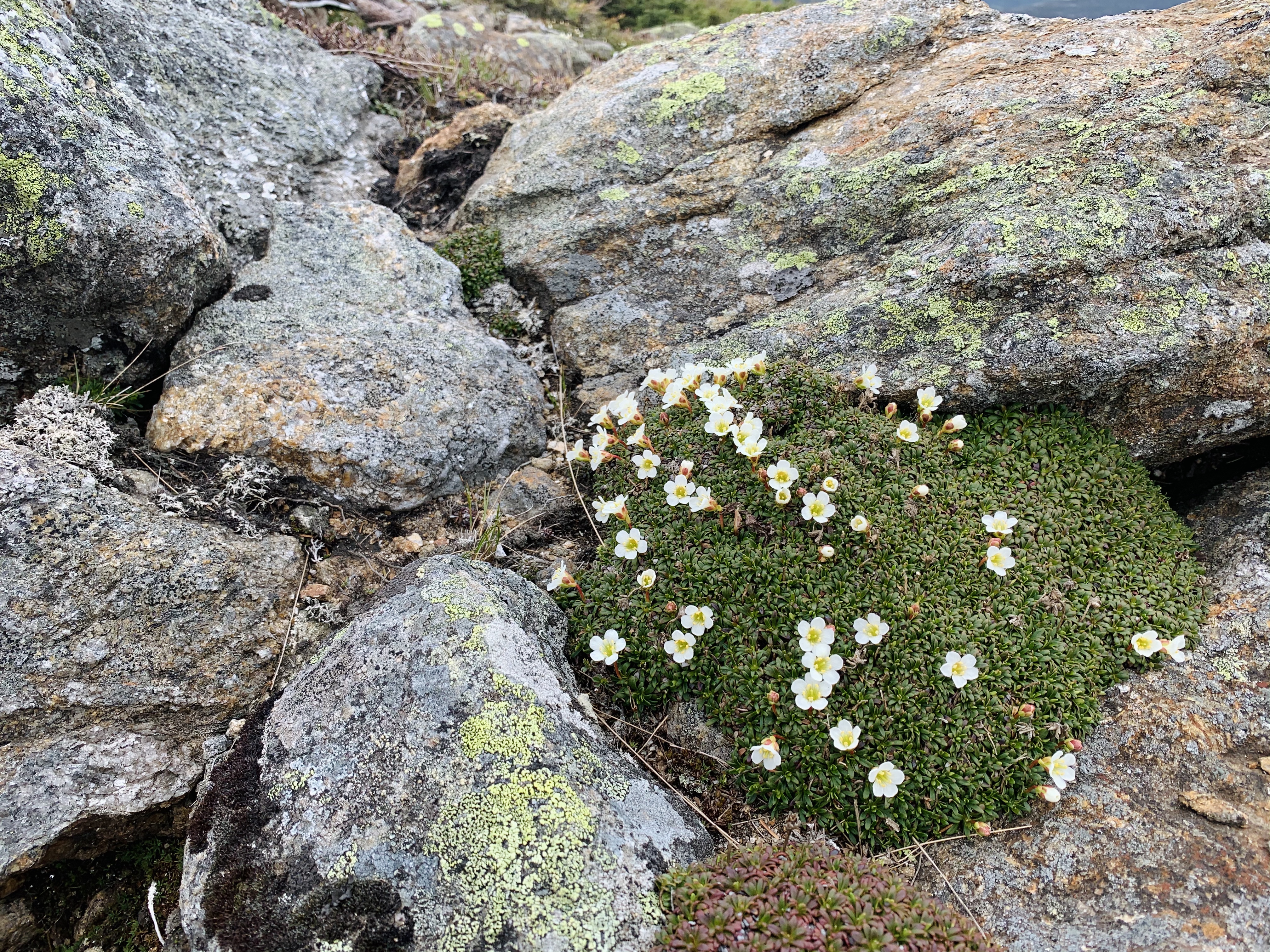
From Monroe to Eisenhower is one of my favorite stretches of trail, it’s gorgeous and Crawford Path is quite lovey especially after a morning of Northern Presidential rock hopping. Along this stretch we were also welcomed with a good amount of alpine flowers! We were also playing leap frog a bit throughout the day with another hiker who was out for a full traverse that day, and passed him again on this section. It’s always entertaining leapfrogging throughout the day and saying to people “oh, hey there again!”.
Diapensia
Crawford Path between Monroe and Eisenhower
When we reached the Eisenhower summit we were shocked to be the only two humans there. THIS.DOES.NOT.HAPPEN. Grateful to have this experience.
Between Eisenhower and Pierce is the first stretch of treeline we had been in since popping out early morning and it felt so warm being out of the wind and in the humidity (a trend that has decided to stick around… again, hello summer.) I even ended up changing from the leggings I had been in all day to shorts a little further on because #teamnopants and I had them in my pack so why not?! Perks of packing shorts: you can change into them if able, or if you get cold you can keep your bum warm but putting them over your pants… a little protip (but please don’t try this in winter… or at a minimum at least pack a second pair of pants too).
Looking at the trail to Pierce from Eisenhower
Jess
One neat thing about this day, was that exactly three years prior I had hiked Pierce which was my first 4000 footer back after stress fracturing my fibula. I wouldn’t have know this had social media not told me, but I found this really eye opening to how far I’ve come and how much progress has been made as these years have elapsed. Pierce was also my first solo hike, so needless to say this mountain holds a special place in my heart.
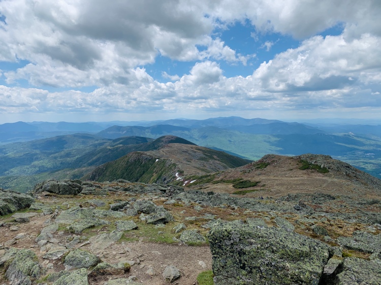
View from Pierce. And some rad clouds.Another closed hut (Mizpah hut)
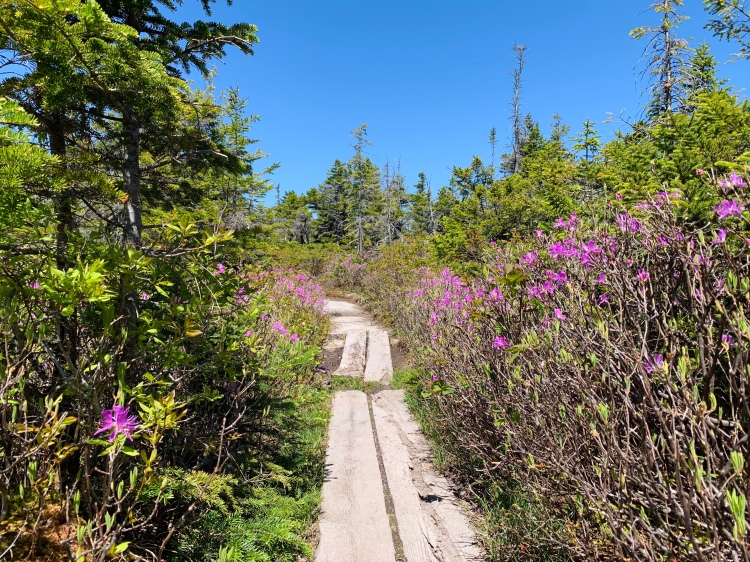
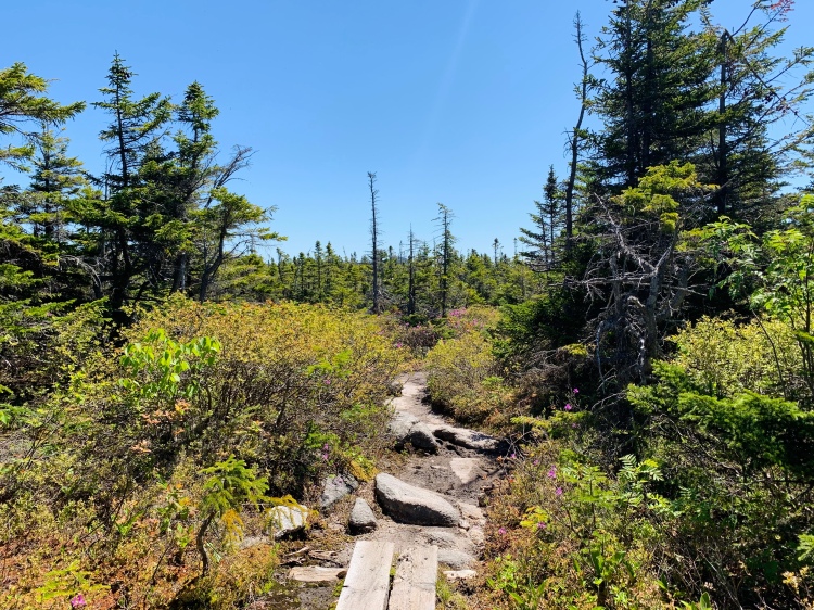
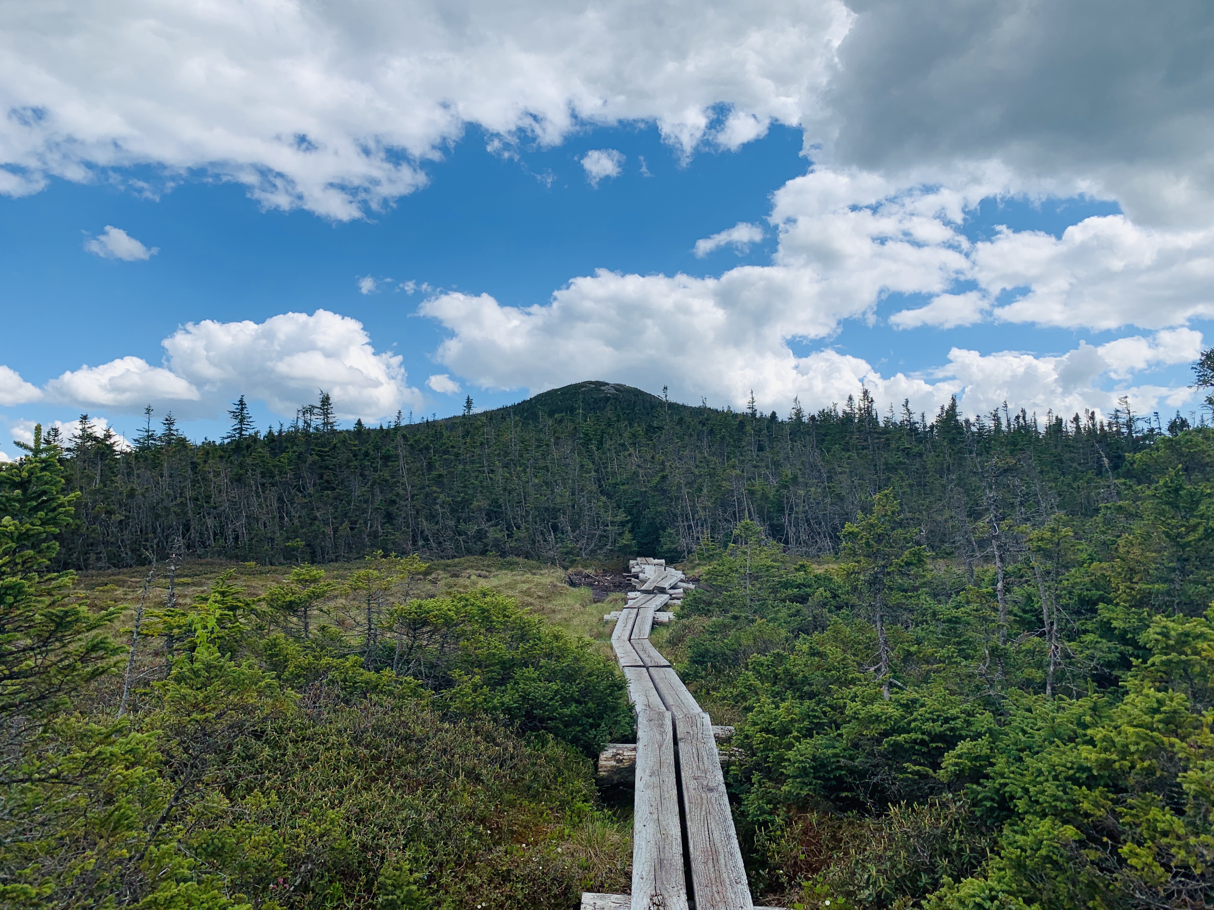
Between Pierce and Jackson is another neat section of below tree-line trail. The trail passes by another hut which alike Lake of the Clouds hut, was closed. For the most part, once off of the Pierce summit the trail is fairly moderate and there are some flat sections which felt like gold for the feet after the morning. My favorite part of this section of trail has to be the bog bridges!
The final stretch headed towards Jackson
Once on Jackson we had another food break before the final descent to the car. Jackson was technically my first 4000 footer well before I got into hiking or knew what the 4000 footers were. Each time I’m on this summit I can’t help but think back to what my life was like at this point, similarly to Pierce on this day I suppose. I think the reflection is important, and there has sure been a lot of it this month. Hiking has been such a pivotal addition to my life, and I hope it’s something that I’m always capable of doing in some capacity. For the current moment, I’m grateful for a body that allows me to pursue “hiking projects”.
“I think things are beautiful when you don’t plan them, and you don’t have any expectations, and you’re not trying to get somewhere in particular.” – Alison Mosshart
It’s been a hot minute… month… two months. With current world/life events, I’ve found myself extremely uninspired to write/blog/create. Instead of forcing it out of feeling like I “should” or that I need to be productive – I’ve given myself the space and time needed to just be with my thoughts and feelings throughout the past two months. Honestly, I’m really proud of myself for this too. I’m a “doer”, and slowing down to give space doesn’t come naturally for me. At all.
Quickie life update: I’m furloughed from my part-time job until mid-July, the gym I was about to begin personal training at is closed, I will likely be done my Sports Nutrition Certification early/mid July, haven’t watched the news in a few weeks, my living situation is very socially distant, my 7 year recovery anniversary was the first weekend of May, I’ve come to conclusion that I’m an extremely independent introvert, and it’s been feeling like summer this week and I’m BEYOND giddy.
The past few weeks have felt a little more “normal”. While far from normal, I’ve been hiking again and having some (distant) social contact. Both of these have proven to be very helpful. I’m grateful to live in an area and be in a position where these are even possible.
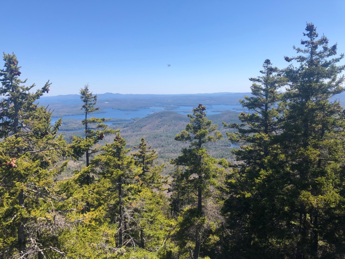
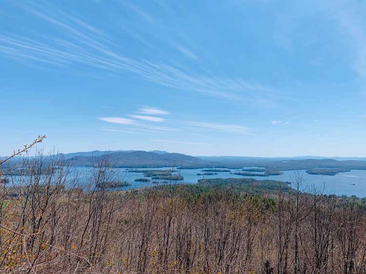
View from Cotton Mountain, NH
Last Thursday, my friend Jess and I hiked the Squam Range Traverse in the Lakes Region of NH! If you’re a follower of my blog, you might be asking “who is Jess?!”. This is a fun story. So, good ol’ social media land – Jess and I have followed each other on Instagram for a while and had been chatting on occasion about hiking and such. Both of us had been doing lots of local walks and we just happened to run into (not literally) when I was out for a walk on my road and recognized each other! How crazy, right?! Anyways, we’ve gone on a handful of walks and hikes since and I’m stoked to have a new gal pal/adventure partner in crime.
Both of us have been taking social distancing, keeping local, and staying off the higher summits very seriously. For me, April consisted of road walks mainly from my apartment, lifting in the basement, and towards the end of the month a few local hikes. May has included some less local hiking, still within an hour drive. Insert Squam Range Traverse.
This hike is a gem and about 35-40 minutes from where I live. The most interesting part of the day was needing a car spot so during the 20 minute drive from each end of the hike in the morning and afternoon, Jess and I wore facemasks in the car – an interesting experience to say the least. Interesting, potentially overkill seeing we are both in the VERY UNLIKELY category, but important right now.
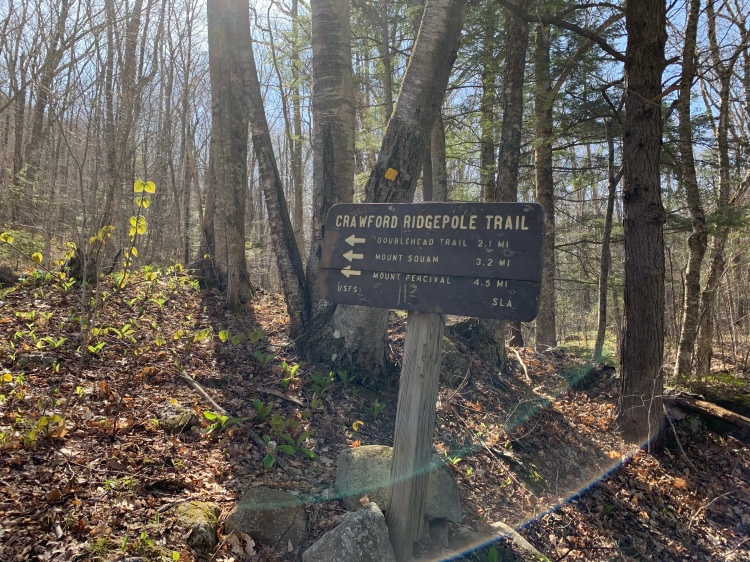
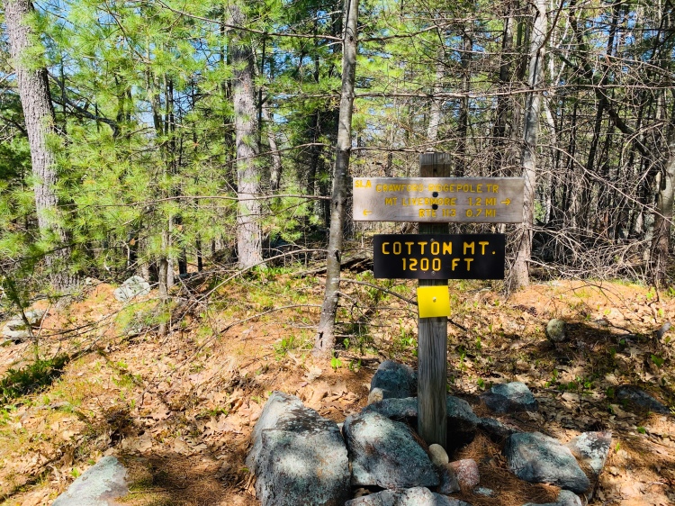
Crawford Ridgepole Trail sign
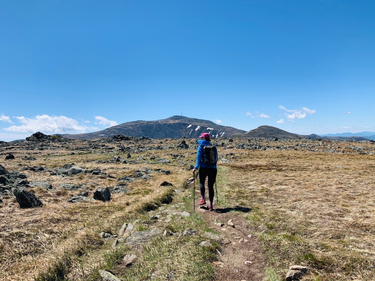
With not wanting to hike the higher summits at the current moment, trying to avoid snow as much as possible (real talk: over it), and wanting a slightly longer hike, we opted for the Squam Traverse. With where our cars were parked it was a 11.5 mile and 3,894ft vert. hike… according to Strava that is.
This traverse crosses over seven peaks – Cotton Mountain, Mt. Livermore, Mt. Webster, Mt. Morgan, Mt. Percival, Mt. Squam, and East Doublehead. Ups and downs throughout the day.
More trail time has felt like home. Pure bliss. I’m so thankful to have these mountains either in my backyard or relatively close to it. Moving North last October was hands down one of the best decisions I’ve made in my entire life for a handful of reasons… and that is being solidified almost daily at the moment in terms of location and feeling safe.
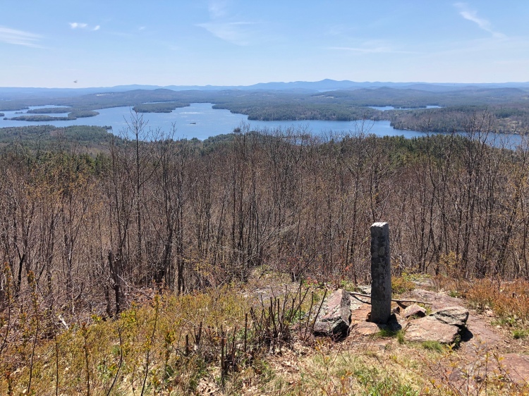
From Mt. Livermore
Before this hike, Jess and I had hiked the Morgan Percival loop the week prior and I low-key fell in love with the Squam Range (and the short drive to it). This range is beautiful, the drive is through a rural country area for the most part, and well it was Spring here before it was Spring where I live. Triple win. One “silver lining” of all that is going on in the world right now, is that I’ve been able to find new places and expand my scope a bit. On this, it feels off to say “silver lining”, because I still wish this wasn’t all happening. But I’m trying my best to be safe, make calculated decisions, be kind, and support myself and my friends/family to the best of my current ability. And with supporting myself to the best of my current ability comes hiking. Because for me, hiking is, and has always been, a form of self-care. It just looks a little different right now.
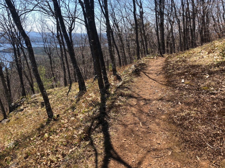
Trees!
Being in the mountains more recently after about a month and a half of staying home/very close to home has reminded me why I hike and why the mountains feel like home. I think it’s easy to get caught up in the daily grind and not take a step back and remember the WHY behind why we do what we do. While the forced “step back” isn’t ideal, it’s definitely got me thinking. A lot of my thoughts lately have been kept fairly private vs. the usual blogging, instagram story tangents, or even just talking about them. I’ve needed the additional solitude, alone time, space to just be and process for my own mind.
One of the biggest lessons hiking, or more specifically the trail, has taught me – it’s all about the process. The golden nuggets are found in the process.
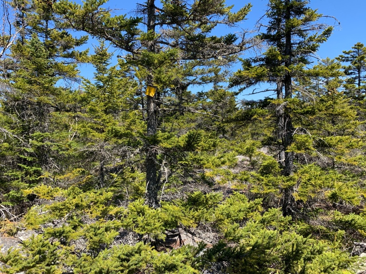
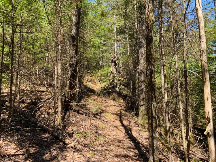
Crawford Ridgepole Trail, NH
While I’m not sure what is to come in terms of… well… anything really (anyone have a crystal ball?) – I look forward to future trail time and trying to just keep doing my best at navigating whatever is throw in my direction with the uncertainty of the world.
“When I feel lost, I remember I am not the woods. I am my own tree.” – Glennon Doyle